Descrizione
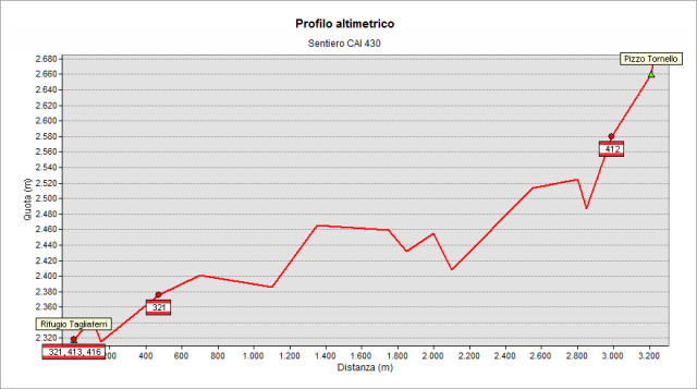
Starting from Tagliaferri Refuge (2328 m) follow the path n° 413 to the valley for a few meters. Then leave it and go up on the right, following for a while the path n° 321. Then leave it and climb on the left continuing toward south to the always visible Tornello Peak. You reach the path n° 412, finally, and - with shared path - you quickly reach the summit (2687 m).
Topografia
Salita
ca. 400 m
Discesa
ca. 0 m
Lunghezza
circa 3300 metri
Profilo altimetrico

Sentieri collegati
Documentazione
Cartografia
Carta Escursionistica della Provincia di Bergamo
Tavola 03
Bibliografia
http://www.scalve.it/sentieri/